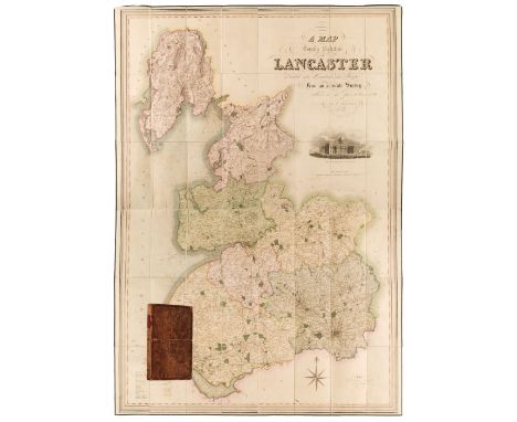

Lot 107
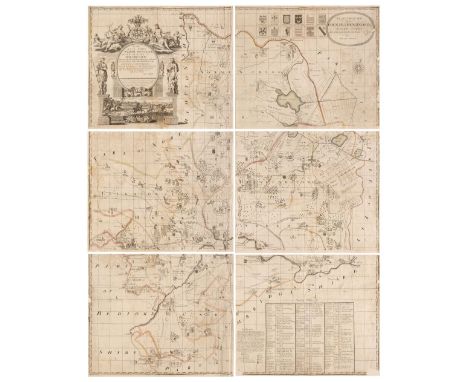
Lancaster. Hennet (George), A Map of the County Palatine of Lancaster Divided into Hundreds and Parishes from an accurate survey made in the years 1828 and 1829, London: Henry Teesdale and Co. May 1st, 1830, engraved map with contemporary hand-colouring, sectionalised and laid on linen with calligraphic cartouche, compass rose, table of explanation and vignette of the New Custom House Liverpool, some offsetting and staining, edged in green silk (some fraying), marbled endpapers, 1600 x 1112 mm, contained in a contemporary calf book box (spine scuffed, corners bumped) QTY: (1)