No Image Lot 411 Bacon (George W): Bacon's New Survey Map of South Scotland - scale 1 inch to 3 miles, folding map in 411Bacon (George W): Bacon's New Survey Map of South Scotland - scale 1 inch to 3 miles, folding map in Tayler & Fletcher Bacon (George W): Bacon's New Survey Map of South Scotland - scale 1 inch to 3 miles, folding map in original red cloth gilt covers, with combed m... Add to watchlist Live
No Image Lot 176 Cary (John); 'Cary's New Map of England and Wales - with part of Scotland on which are carefully 176Cary (John); 'Cary's New Map of England and Wales - with part of Scotland on which are carefully Chilcotts Cary (John); 'Cary's New Map of England and Wales - with part of Scotland on which are carefully laid down All the Direct and Principal Cross Road... Add to watchlist Live
No Image Lot 182 Lewis (Samuel); 'A Map of Scotland Divided into Counties Shewing The principal Roads, Railways, 182Lewis (Samuel); 'A Map of Scotland Divided into Counties Shewing The principal Roads, Railways, Chilcotts Lewis (Samuel); 'A Map of Scotland Divided into Counties Shewing The principal Roads, Railways, Rivers, Canals, Lochs, Mountains, Islands, &c. On ... Add to watchlist Live
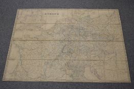
Reserve not met No Image Lot 511 Folding Map. Wyld, James - Post Map of Europe. London: 1845. Coloured in outline, dissected in 40 511Folding Map. Wyld, James - Post Map of Europe. London: 1845. Coloured in outline, dissected in 40 1818 Auctioneers Folding Map. Wyld, James - Post Map of Europe. London: 1845. Coloured in outline, dissected in 40 sections. Depicts roads, railways and sea-routes... Add to watchlist Timed
No Image Lot 80 A large collection of maps, to include: Speed (John), Hartfordshire Described, The Sittuations of... 80A large collection of maps, to include: Speed (John), Hartfordshire Described, The Sittuations of... Roseberys London A large collection of maps, to include: Speed (John), Hartfordshire Described, The Sittuations of Hartford and the most ancient Towne St. Albons w... Add to watchlist Live
No Image Lot 243 Manchester. Britain’s Best Centre for Touring and Business..., colour lithographic poster 243Manchester. Britain’s Best Centre for Touring and Business..., colour lithographic poster Dominic Winter Auctions * Manchester. Britain’s Best Centre for Touring and Business. Fly to Ringway Airport… via Sabena (Belgium Airlines), 1954, colour lithographic pos... Add to watchlist Live
No Image Lot 472 Two albums containing more than 265 postcards of East Sussex – specifically Hastings (110 cards), 472Two albums containing more than 265 postcards of East Sussex – specifically Hastings (110 cards), Nesbits Auctions Ltd Two albums containing more than 265 postcards of East Sussex – specifically Hastings (110 cards), Pevensey (46), Rye (66) and Bexhill (44). The Ha... Add to watchlist Live