Refine your search
Sale Section
Estimate
Category
- Books & Periodicals (197)
- Maps (137)
- Prints (18)
- Musical Instruments & Memorabilia (8)
- Sporting Memorabilia & Equipment (8)
- Collectables (5)
- Entertainment Memorabilia (5)
- Classic Cars, Motorcycles & Automobilia (3)
- Stamps (3)
- Arms, Armour & Militaria (2)
- Decorative Art (1)
- Drawings & Pastels (1)
- Models, Toys, Dolls & Games (1)
- Oil, Acrylic paintings & Mixed Media (1)
- Photographs (1)
- List
- Grid
A subscription to the Price Guide is required to view results for auctions ten days or older. Click here for more information
MAP: SPEED, J:
MAP: SPEED, J: Britain as it was devided in the Tyme of the Englishe Saxons. C1627 or later. Hand coloured, mounted, framed & glazed (37.5 x 50cm)...
SPEED, John- Two Maps: 1- Essex devided into Hundreds, with the most ancient and fayre Towne Colchester Described and other Memorable Monuments ob...
MAP- Hertfordshire- Speed, John: Hartford Shire described the sittuations of Harford, and the most ancient towne S. Albons with such memorable act...
MAP- Derbyshire- Speed, John: Darbieshire described 1610. John Sudbury & George Humblell, c 1627. Hand coloured, mounted, framed & glazed, 42 x 53...
MAP: SPEED, J:
MAP: SPEED, J: The Kingdome of Great Britaine and Ireland. (1653). Hand coloured, mounted, framed & glazed (39 x 52cm) ...[more]
MAP: SPEED, J:
MAP: SPEED, J: The Kingdome of England. c1646. Hand coloured, mounted, framed & glazed (39.5 x 52cm) ...[more]
John Speed's England
John Speed's England - A Coloured Facsimile Of The Maps And Text From The Theatre Of The Empire Of Greate Britaine, Edited by John Arlott, In 4 vo...
SPEED, John:
SPEED, John: MAP OF WALES. 1610, hand coloured, mounted, glazed and framed (38.5 x 51cm) From the Paul Bentley collection of maps and atlases. C...
Morden: ESSEX, Five maps, three are hand coloured, and all mounted, framed & glazed, largest 36 x 42cm, smallest 18 x 21.5cm. (5) ...[more]
Morden: Four Maps- Hertfordshire; Suffolk; Derbyshire; & Britannia Romana, c1753. The first three are hand coloured, largest 37.5 x 45cm, smallest...
MAPS: MORDEN, R: 1- Britannia Romana. ND, C1627. Hand coloured, mounted, framed & glazed, (36.5 x 44), and ENGLAND. ND, Hand coloured, mounted, fr...
Robert MORDEN-
Robert MORDEN- Two maps: Scotland; & Suffolk. Both hand coloured. (2) ...[more]
MORDEN MAP of the Kingdom of IRELAND- Hand-coloured, measuring approximately (35 x 40cm), mounted, framed & glazed. ...[more]
Five MORDEN MAPS - The LAKES & Surrounding, All Hand-coloured, measuring approximately (34 x 40cm), mounted, framed & glazed: Northumberland; Durh...
Four MORDEN MAPS, plus one
Four MORDEN MAPS, plus one- All hand-coloured, measuring approximately (34 x 40cm), mounted, framed & glazed: Lincolnshire; Huntingdonshire; Derb...
Four MORDEN MAPS
Four MORDEN MAPS- All Hand-coloured, measuring approximately (34 x 40cm), mounted, framed & glazed. Hertfordshire; Norfolk; Suffolk; & Middlesex; ...
Four MORDEN MAPS
Four MORDEN MAPS- All Hand-coloured, measuring approximately (34 x 40cm), mounted, framed & glazed: Kent; Devonshire; Gloucestershire; & Oxfordshi...
Two MORDEN MAPS
Two MORDEN MAPS- Both Hand-coloured, measuring approximately (34 x 40cm), mounted, framed & glazed: Smaller Islands of the British Ocean, c1695; &...
Two MORDEN MAPS
Two MORDEN MAPS- Both hand-coloured, measuring approximately (34 x 40cm), mounted, framed & glazed: Britannia Romana; & Britannia Saxonica. (2) ...
Three MORDEN MAPS
Three MORDEN MAPS- Two hand-coloured, measuring approximately (34 x 40cm), mounted, framed & glazed: Monmouth; North Wales; & South Wales (not col...
Two Morden maps,
Two Morden maps, both hand coloured, England, (36.5 x 42cm) and Buckinghamshire, (43 x 36cm), and a smaller map, De L'Europe figure 11, (18.5 x 12...
BLEAU: ESSEXIA COMITATUS QUEM OLIM TRINOBANTES. Essexia Comitatus Quem Olim Trinobantes tennerunt contiens in se opida marcatoria xx Pagos et Vill...
Two MAPS: 1- Emanuel Bowen: An Accurate map of the County of Essex, Divided into its Hundreds. Dedicated to Benjamin Mildmay Earl Fitzwalter. C176...
Four Essex MAPS: Emanuel Bowen: An Accurate map of the County of Essex, Divided into its Hundreds. Dedicated to Benjamin Mildmay Earl Fitzwalter. ...
Two ESSEX Maps: 1- Speed, John: Essex devided into Hundreds, with the most ancient and fayre Towne Colchester Described and other Memorable Monume...
MAPS: SAXTON: A Map of Suffolk, corrected and amended with many additions… C1720, with a fold in the middle. Please find enclosed a copy of a lett...
MAP: SMITH: A new Mapp of the county of Suffolk with the post and cross roads and other remark according to the latest and best observations, Smit...
SAXTON (Suffolk):
SAXTON (Suffolk): Suffolciæ Comitatus (cuius Populi olim iccni dic ti) Continens in se oppida marcatoria. Hand coloured. ...[more]
HERTFORDSHIRE and ESSEX MAPS
HERTFORDSHIRE and ESSEX MAPS: A quantity of loose maps, some hand coloured. (qty.) ...[more]
SUSSEX Map:
SUSSEX Map: FADEN, W: A topographical map of the county of SUSSEX, divided into Rapes, Deaneries & Hundreds, planned from an actual survey by a sc...
FADEN, William (publisher):
FADEN, William (publisher): A Plan of His Majesty's Forest, called The New Forest, in the County of Southampton laid down from Surveys taken by Th...
MAP: Ortelius, A:
MAP: Ortelius, A: Cambriae Typus Auctore Humfredo Lhuydo. No date, hand coloured, mounted, glazed and framed (36.5 x 48.5cm) From the Paul Bentle...
MAPS: COLBY, Col:
MAPS: COLBY, Col: Map of Cambridgeshire. Engraved by B. Baker, 1834. Linen backed, folding with marbled ends and slipcase. (150 x 140cm); COLBY, C...
GREENWOOD: Map of the County of Kent, from an actual survey made in the years 1819 & 1820, published by G. Pringle, July 19, 1821. Engraved by Nee...
Two MAPS: 1- Warwicum Northamtonia Huntingdonia Cantabrigia Suffolcia Oxonium Buckinghamia Bedfordia
Two MAPS: 1- Warwicum Northamtonia Huntingdonia Cantabrigia Suffolcia Oxonium Buckinghamia Bedfordia Hardfordia. C1636; 2- JANSSON, Jan: Middelsex...
OGILBY ROAD MAPS:
OGILBY ROAD MAPS: The Road from St Davids com Pembroke to Holywell, 1781; The Continuation of the Road from St Davids to Holywell. (45 x 35 cm) ea...
FENS MAP: WELLS, Samuel:
FENS MAP: WELLS, Samuel: The Great Level of the Fens Called Bedford Level. Cary, the Fen office, 27 March, 1829. Hand coloured, linen backed and f...
MAPS: COLBY, Col:
MAPS: COLBY, Col: A set of 9 Ordnance survey maps of South-East England, 1844. Hand coloured, linen backed and folding. Housed in the original ful...
MAPS: Ordnance Survey Maps:
MAPS: Ordnance Survey Maps: 1- # 41 (4 sheets), 42 (4 sheets), & 57 (3 sheets), all linen backed, folding, with grey paper ends, and housed in one...
MAPS: STANFORD, E:
MAPS: STANFORD, E: 1- Geological Survey of England and Wales No: VIII. 1887. Hand coloured, linen backed and folding with one marbled paper end (9...
BRADSHAW, G:
BRADSHAW, G: Map of Canals, Navigable Rivers, Railroads etc. of the Midland Counties of England from Actual Survey,.. Manchester, A Prentice, 1829...
MAP: Visscher (Nicolaes),
MAP: Visscher (Nicolaes), Magnae Britanniae Tabula Angliam, Scotiam et Hiberniam..., circa 1670, Hand coloured, mounted, framed & glazed (45 x 53c...
OGILBY, John: Two Road Maps:
OGILBY, John: Two Road Maps: The Road from Chelmsford in Essex to St. Edmonds-Bury in Suffolk & Safron-Walden in Essex. C1675; And: The Road from ...
Three Road Maps by John OGILBY: The Road from London to Yarmouth; Ipswich to Norwich; & London to Harwich. The first two are hand coloured. (3) ....
LOADER’S Scientific & Commercial Map of England and Wales in which are delineated the canals, rail-roads & navigable rivers, the extent of the nav...
MAPS: BARTHOLOMEW, J:
MAPS: BARTHOLOMEW, J: The Imperial Map of England & Wales, according to the ordnance survey with the latest additions, shewing clearly every featu...
Gillray (James). A New Map of England & France. The French Invasion. Or John Bull bombarding the Bum-Boats. H. Humphrey Nov 5th 1793 [but H. G. Bo...
MAPS: COLTMAN, Nath:
MAPS: COLTMAN, Nath: New Map of South Wales. Laurie and Whittle, 1st. Jan 1798, 4th. Edn. With considerable additions… to 1807. Linen backed, fold...
WILLIAMSON, Capt. Robert:
WILLIAMSON, Capt. Robert: Directions for a general Chart of St. Georges's Channel: containing a particular description of the Barings of each land...
Early Plan of JERUSALEM:
Early Plan of JERUSALEM: Hierosolyma, Clarissima Totius Orientis Civitas Iudaee Metropolis. Two bird's eye views. On the left Jerusalem in biblica...
Mercator: AUSTRIA ARCHIDUCATUS 1593. Hand coloured, mounted, framed & glazed, 24.5 x 34cm. ...[more]
NEW ZEALAND MAPS:
NEW ZEALAND MAPS: Chart of New Zealand, explored in 1769 and 1770, by Lieut. J Cook, Commander of His Majesty's Bark Endeavour. No date, I47x36cm)...
NEW ZEALAND MAPS:
NEW ZEALAND MAPS: Hughes, W: Map of New Zealand with small inset maps of Tasmania and Western Australia, no date, C1853 (38 x 26cm); Hogg, A: Char...
The THAMES:
The THAMES: 1- Taunt, H W: A new map of the River Thames from Oxford to London. No date, 5th. Edn. With a photographic frontis, 2 plates, a foldin...
Taunt, H W:
Taunt, H W: A new map of the River Thames from Oxford to London. No date, 3rd. Edn. (1879). With a frontis, general map of the Thames, plus 33 dou...
Taunt, H W:
Taunt, H W: A new map of the River Thames from Oxford to London. Oxford, (1872) preface dated, 1st. edn. With 24 colour maps and 79 small albumen ...
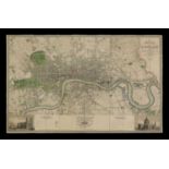
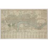
LONDON MAP: GREENWOOD, John & Christopher: Map of London from Actual Survey Made in the Years 1824, 1825 & 1826. Published August 21. 1827, first ...
LONDON MAP: GREENWOOD, John & Christopher: Map of London from Actual Survey Made in the Years 1824, 1825 & 1826. Published August 21. 1827, first ...
Cary's Survey of the High Roads from London to Hampton Court... With the number of inns & turnpikes. J Cary, July 1st, 1790. 1st. Edn. With a doub...
Cary's New Pocket Plan of London, Westminster and Southwark with the adjacent buildings.. 1791. Hand coloured, linen backed and folding, with a ma...


