Filtered by:
- Category
- List
- Grid
This auctioneer has chosen to not publish their results. Please contact them directly for any enquiries.

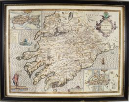
JOHN SPEED CIRCA 1610
17th century engraved and hand-coloured map of Connaugh. Provenance: The Dr. Kevin Moynihan Collection, Macroom, Co. Cork. Approximate Time: 15:...
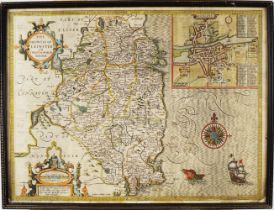
JOHN SPEED CIRCA 1610
17th century engraved and hand-coloured map of Leinster. Provenance: The Dr. Kevin Moynihan Collection, Macroom, Co. Cork. Approximate Time: 15:...
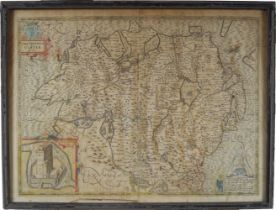
JOHN SPEED CIRCA 1610
17th century engraved and hand-coloured map of Ulster. Provenance: The Dr. Kevin Moynihan Collection, Macroom, Co. Cork. Approximate Time: 15:50...
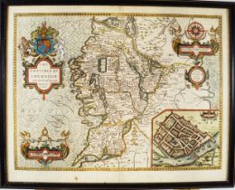
JOHN SPEED CIRCA 1610
17th century engraved and hand-coloured map of Munster. Provenance: The Dr. Kevin Moynihan Collection, Macroom, Co. Cork. Approximate Time: 15:5...
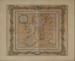
18TH-CENTURY MAP OF IRELAND
L Irlande divisée Par Provinces Civiles et Ecclesiastiques Par Mr. Brion. à Paris, 1766. Framed. 45 x 54 cm. Approximate Time: 16:36 Lot No: 464
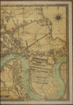
CRUCHLEY'S NEW MAP OF LONDON
Incorporating proposed new Collier Docks. In three parts, each framed. 20th-century. 59 x 40 cm.; framed; 70 x 52 cm. Approximate Time: 16:36 Lot ...
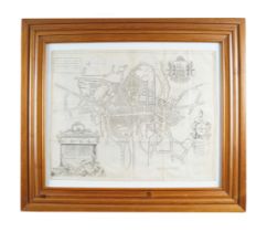
MAP OF CORK CITY FROM 1750
This map first appeared in Charles Smith's The ancient and present state of the county and city of Cork (Dublin, 1750). Approximate Time: 16:39 ...
divided into provinces, counties and baronies. Southern section. Showing the archbishoprics, bishoprics, cities, boroughs, market towns, villages,...
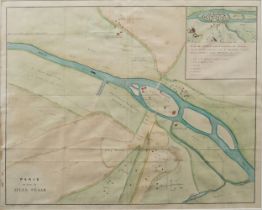
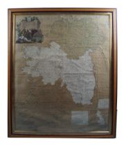
EARLY 19TH-CENTURY MAP OF PARIS
Map of Lutetia before the Roman domination, about 55 BC. taken from DELAMARE, according to CÉSAR, STRABON, JULIEN MARCELLIN etc. Published by Leme...