Filtered by:
- Item Type
- List
- Grid
A subscription to the Price Guide is required to view results for auctions ten days or older. Click here for more information
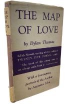

DYLAN THOMAS: THE MAP OF LOVE, London, J M Dent and Sons, 1939. First edition with original unclipped dustjacket. Some wear and fading, losses to ...
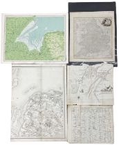
Five mixed maps, to include: J Bartholomew coloured engraved map, 'The Wash' from Survey Atlas 1903,
Five mixed maps, to include: J Bartholomew coloured engraved map, 'The Wash' from Survey Atlas 1903, Section XXII, Plate 33; Benjamin Baker half m...
Pkt: Four assorted maps: 2 x Suffolk, Yorkshire, and Britannia Romana
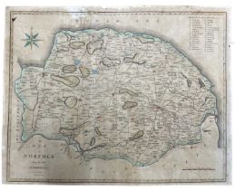
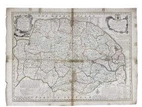
J CARY: Coloured engraved map 'A Map of Norfolk from the Best Authorities', c1805 Size approximately: 42x54cm;
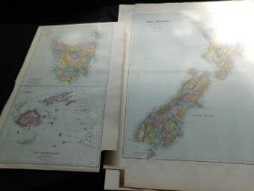
Pkt: Nine Stanford large folio maps, 1887, Australia, New Zealand and Pacific
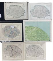
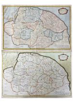
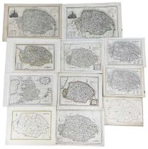
Six various coloured maps of Norfolk, to include: Walker's map of Norfolk, 1861, marked up for fox-
Six various coloured maps of Norfolk, to include: Walker's map of Norfolk, 1861, marked up for fox-hunting districts; Walker's map of Norfolk, 183...
Eight various coloured maps of Norfolk, to include: Kelly's map of Norfolk, c1900; Weller's map of
Eight various coloured maps of Norfolk, to include: Kelly's map of Norfolk, c1900; Weller's map of Norfolk 1862; E Weller's map of Norfolk for Phi...
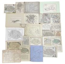
One packet: Various maps, mostly 19th century, British and European
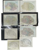
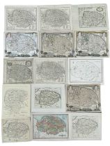
EMAN BOWEN: Coloured engraved map of Norfolk divided into hundreds, 1749. Dedicated to 'The Right
EMAN BOWEN: Coloured engraved map of Norfolk divided into hundreds, 1749. Dedicated to 'The Right Honourable John, Earl of Buckingham, Lord Lieute...
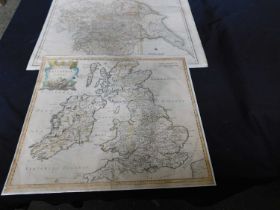
ROBERT MORDEN: Two coloured maps of Norfolk. c1720s.Sizes approximately: 40x60cm
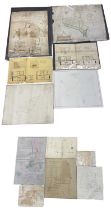
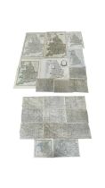
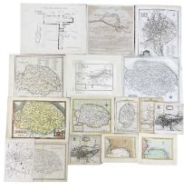
One packet: Mixed architectural plan and maps of Norfolk interest, to include: Hethersett, Wroxham, Carbrooke, Trunch etc
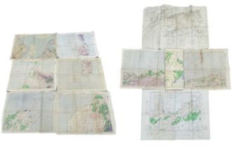
One packet of assorted 20th century maps, various sizes. mostly Mediterranean / North African
One packet of assorted 20th century maps, various sizes. mostly Mediterranean / North African interest
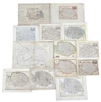
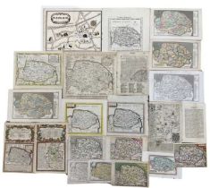
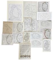
One packet: Assorted engraved maps and book plates of Norfolk, mostly 18th and 19th century.
One packet: Assorted engraved maps and book plates of Norfolk, mostly 18th and 19th century. Assorted sizes
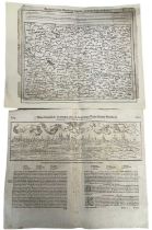
A pair of maps: GERMANY, folio size, woodcut: 16th century, Sebastian Munster, Cosmographia, View of
A pair of maps: GERMANY, folio size, woodcut: 16th century, Sebastian Munster, Cosmographia, View of Worms of Germany, German black letter to rect...
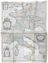
WILLIAM BERRY: A pair of 17th century engraved maps, to include: THE KINGDOM OF FRANCE DISTINGUISHED
WILLIAM BERRY: A pair of 17th century engraved maps, to include: THE KINGDOM OF FRANCE DISTINGUISHED ACCORDING TO THE EXTENT OF ALL ITS PROVINCES ...
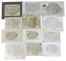
One packet: Assorted engraved maps and book plates of Norfolk, mostly 18th and 19th century.
One packet: Assorted engraved maps and book plates of Norfolk, mostly 18th and 19th century. Assorted sizes
One packet: Assorted engraved maps and book plates of Norfolk, mostly 18th and 19th century. Various
One packet: Assorted engraved maps and book plates of Norfolk, mostly 18th and 19th century. Various sizes
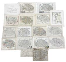
One packet: Assorted engraved maps and book plates of Norfolk, 18th and 19th century, various
One packet: Assorted engraved maps and book plates of Norfolk, 18th and 19th century, various sizes.
One packet: Assorted engraved maps and book plates of Norfolk, mostly 18th and 19th century.
One packet: Assorted engraved maps and book plates of Norfolk, mostly 18th and 19th century. Assorted sizes
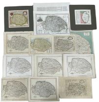
One packet: Assorted engraved maps and book plates of Norfolk, mostly 18th and 19th century.
One packet: Assorted engraved maps and book plates of Norfolk, mostly 18th and 19th century. Assorted sizes
One packet: Assorted engraved maps and book plates of Norfolk, mostly 18th and 19th century.
One packet: Assorted engraved maps and book plates of Norfolk, mostly 18th and 19th century. Assorted sizes
One packet: Assorted engraved maps and book plates of Norfolk, mostly 18th and 19th century.
One packet: Assorted engraved maps and book plates of Norfolk, mostly 18th and 19th century. Assorted sizes
One packet: Assorted engraved maps and book plates of Norfolk, mostly 18th and 19th century.
One packet: Assorted engraved maps and book plates of Norfolk, mostly 18th and 19th century. Assorted sizes
One packet: Assorted engraved maps and book plates of Norfolk, mostly 18th and 19th century.
One packet: Assorted engraved maps and book plates of Norfolk, mostly 18th and 19th century. Assorted sizes
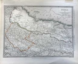
John and Charles Walker (engravers), 'India X', hand coloured engraved map, published 1834 by
John and Charles Walker (engravers), 'India X', hand coloured engraved map, published 1834 by Baldwin & Gradock, unframed, 33.5x41cm, mounted.
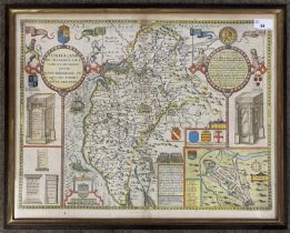
John Speed (British,1552-1629) Cumberland, handcoloured engraved map, circa 1627, 42x53cm, framed
John Speed (British,1552-1629) Cumberland, handcoloured engraved map, circa 1627, 42x53cm, framed and glazed.
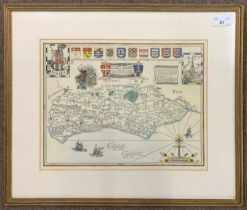
William F. Siebert (British, 20th century), "A Map of Sussex", ink and handcoloured, dated 1960,
William F. Siebert (British, 20th century), "A Map of Sussex", ink and handcoloured, dated 1960, 27x34cm, framed and glazed.
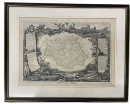
V LEVASSEUR: DEPT DU GERS, engraved map circa 1852, part hand coloured, approx 290 x 420mm, framed
V LEVASSEUR: DEPT DU GERS, engraved map circa 1852, part hand coloured, approx 290 x 420mm, framed and glazed
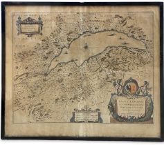
WILLEM JANSSON BLAEU (1571 - 1638): 17th century (c1635) engraved coloured map of Lake Geneva
WILLEM JANSSON BLAEU (1571 - 1638): 17th century (c1635) engraved coloured map of Lake Geneva after J Coulart from an early edition of Blaeu's ATL...
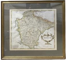
ROBERT MORDEN: DEVONSHIRE, engraved hand coloured map circa 1753, approx 358 x 470mm, framed and
ROBERT MORDEN: DEVONSHIRE, engraved hand coloured map circa 1753, approx 358 x 470mm, framed and glazed
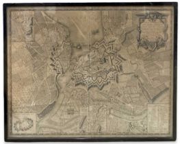
C B GLOT: Uncoloured 18th Century engraved map of Geneva (1777): 'Plan de la Ville de Geneve Corrige
C B GLOT: Uncoloured 18th Century engraved map of Geneva (1777): 'Plan de la Ville de Geneve Corrige sur les lieux, en 1777, et 93 Dedie aux Magni...
![RICHARD BLOME: A MAPP OF YE COUNTY OF ESSEX, engraved hand coloured map [1673], approx 255 x](https://portal-images.azureedge.net/auctions-2024/srkey11011/images/ee0b4d95-39c4-4f4c-978d-b16901312f1b.jpg?h=210)
RICHARD BLOME: A MAPP OF YE COUNTY OF ESSEX, engraved hand coloured map [1673], approx 255 x
RICHARD BLOME: A MAPP OF YE COUNTY OF ESSEX, engraved hand coloured map [1673], approx 255 x 320mm, framed and glazed
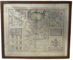
JOHN SPEED: Hand coloured and engraved map of Huntington, both Shire and Shire Towne with the
JOHN SPEED: Hand coloured and engraved map of Huntington, both Shire and Shire Towne with the Ancient Citie of Ely described, 1662Framed and glaze...
ONE BOX: Various 19th and 20th century folding maps